Aller au contenu principal
en
Living
in Saint-Gervais
Stay
in Saint-Gervais
Menu
Saint-Gervais Mont-Blanc
My inspiration
Year-long
Enjoy nature all year round
Cultural life
Top 5 places to have a drink
Discover an exceptional swimming pool
The Mont-Blanc
Focus on...
Screenshot 20211025 095014 Gallery
©
Screenshot 20211025 095014 Gallery
Discover the spa
Boris Molinier Photo Workshop Lou Broche 18
©
Boris Molinier Photo Workshop Lou Broche 18
Mont-Blanc tramway
The best hiking routes
Major events
I want to
Stores and services
Cultural activities
Outdoor and sports activities
Wellness activities
ATV, Fat-Bike & All-terrain scooter
Going out in Saint-Gervais
Eat or drink
Sleep
Activities
I’d like to know more
Plus d'infos pratiques
Coming to Saint-Gervais
Contact us
Virtual tours
Station info
FAQ
The Tourist Office
Webcams
Getting around Saint-Gervais
Plans and brochures
Book my stay
Booking
Mobility
Live info
Virtual tours
Stay
My inspiration
Hiking in all its forms, in all seasons
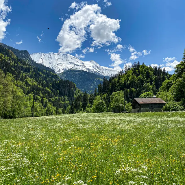
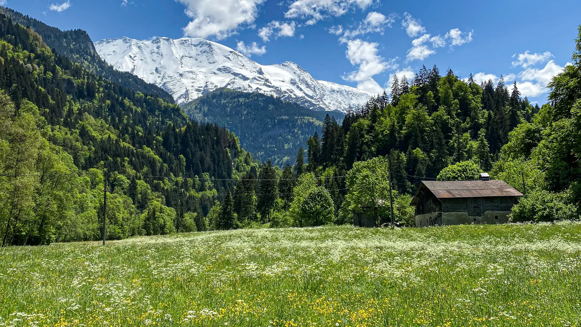
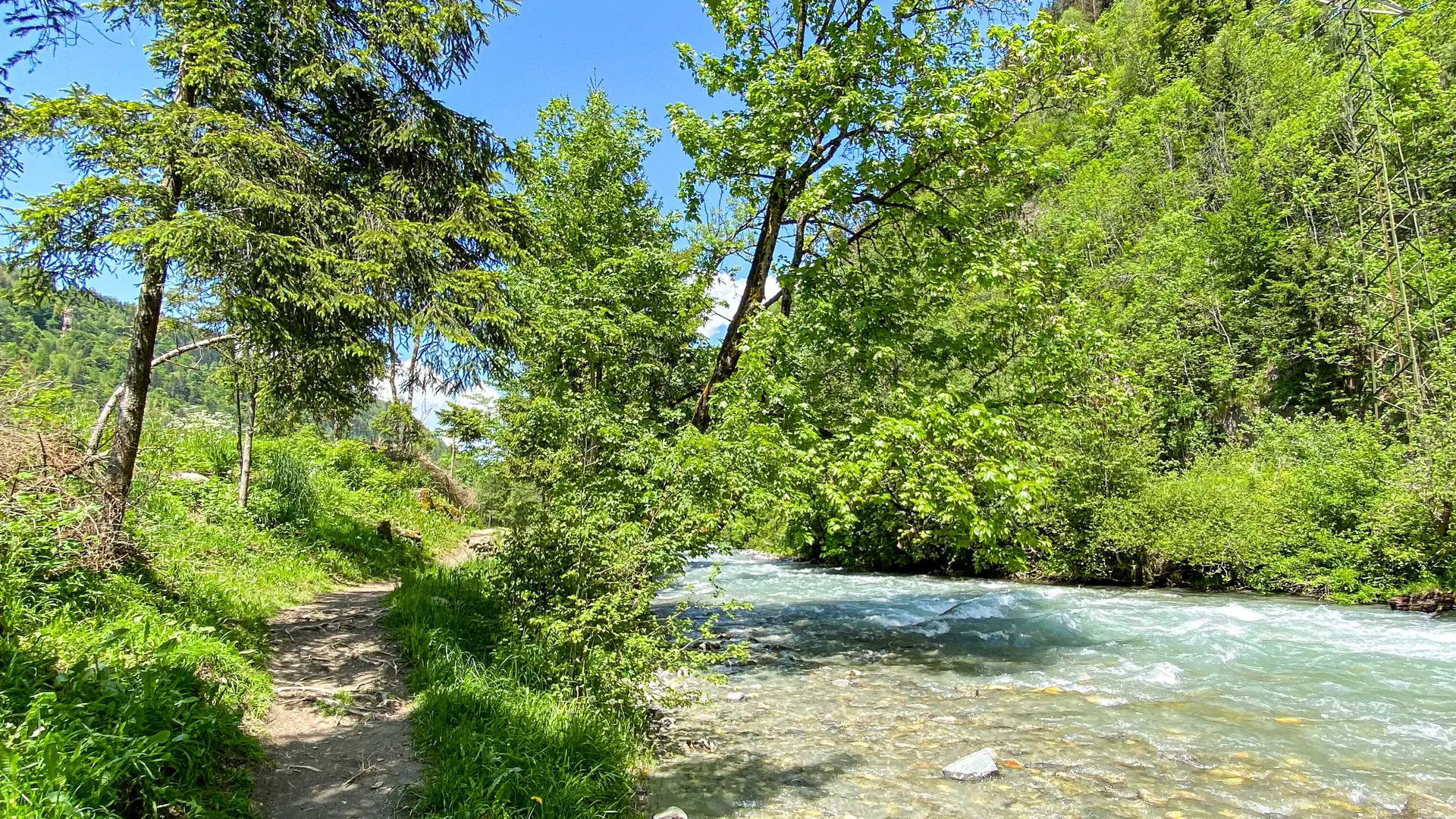
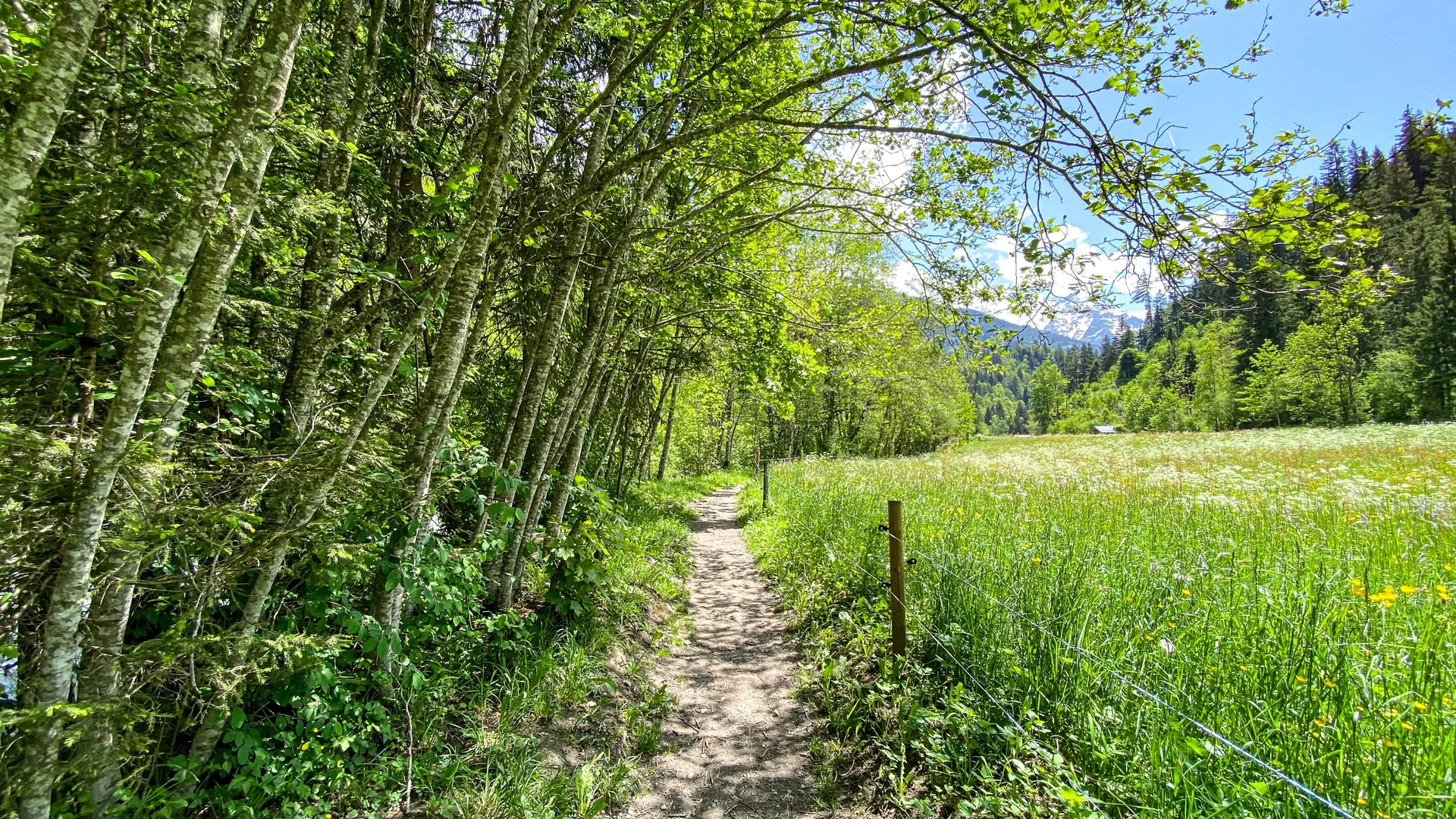
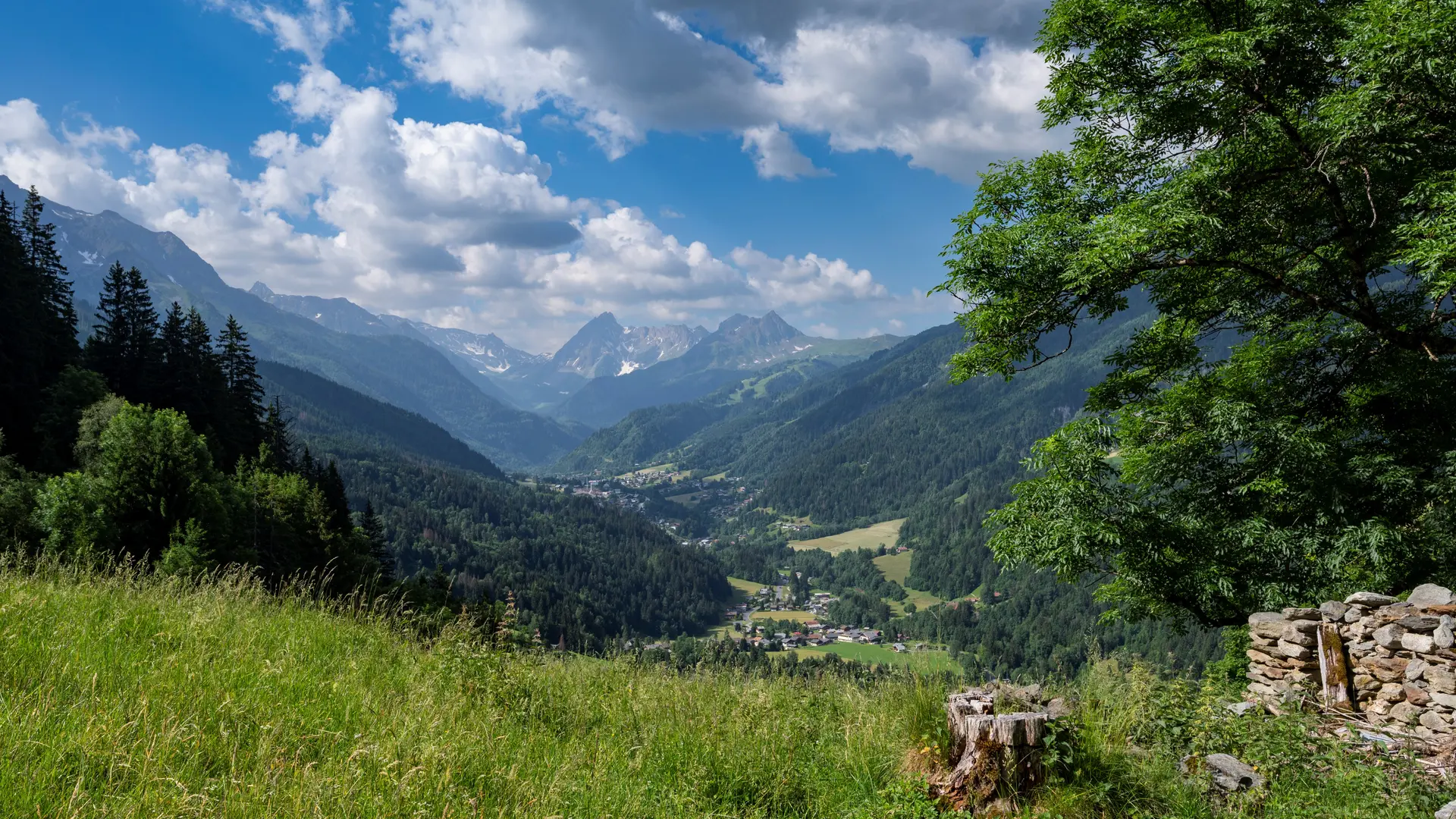
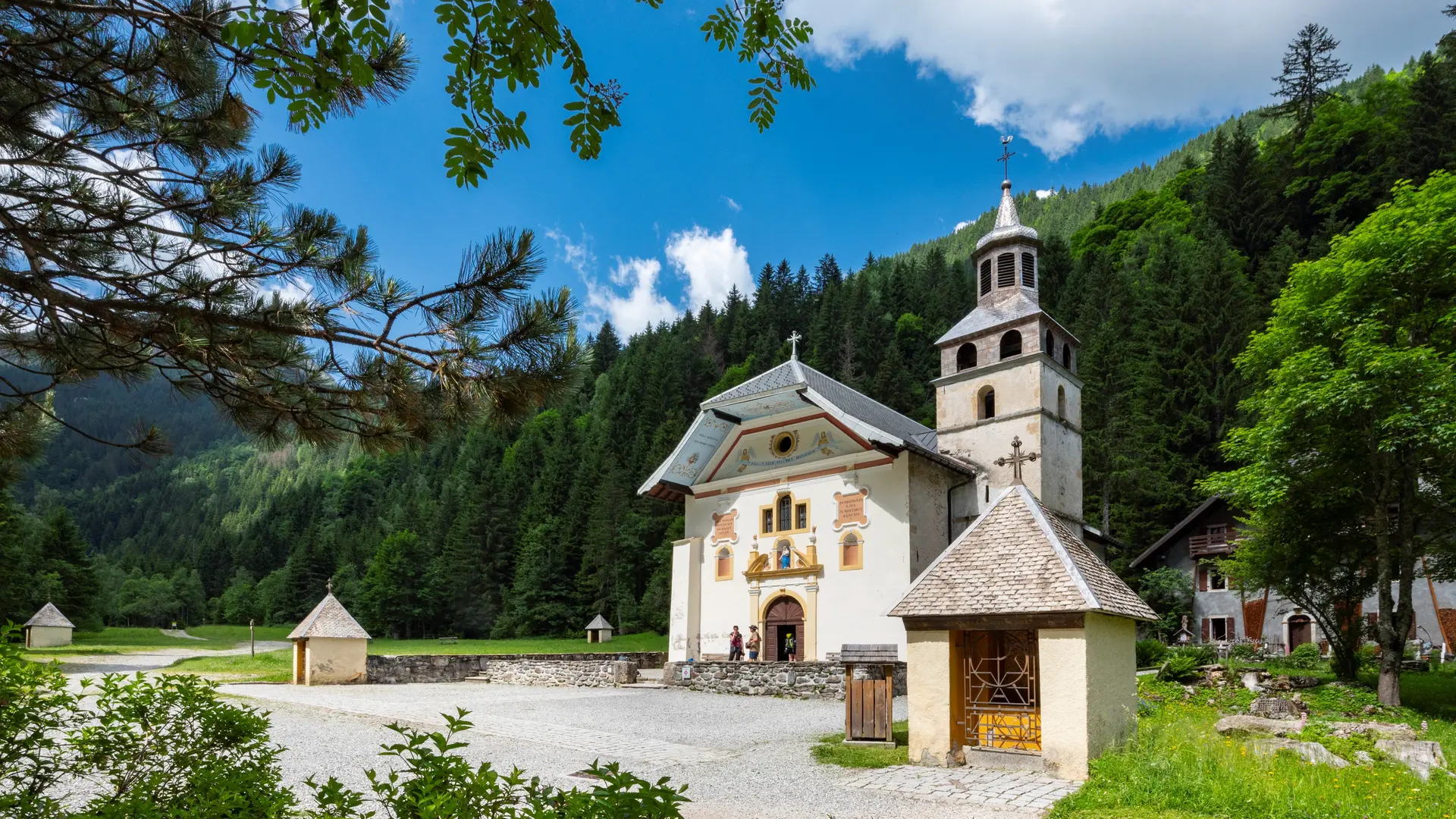
Le sentier du Val Montjoie, de Saint-Gervais aux Contamines
Le sentier du Val Montjoie, de Saint-Gervais aux Contamines
Sport
Pedestrian sports
Hiking itinerary
74170 Saint-Gervais-les-Bains
Getting there
×
Open the itinerary in
Google Maps
Apple Plans
Waze
Mappy
I'm going by train!
×
Please note that the nearest station is more than
Share
×
Share this sheet
Le sentier du Val Montjoie, de Saint-Gervais aux Contamines
E-mail
WhatsApp
Facebook
X
LinkedIn
Pinterest
©
Gilles Lansard
©
Gilles Lansard
×
©
Gilles Lansard
©
Gilles Lansard
Plain text period
All year round.
Subject to favorable weather.
Services
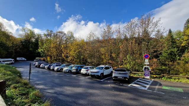
Free car park
Car park
Charging stations for electric vehicles
Play area
Picnic area
Barbecue
Environment
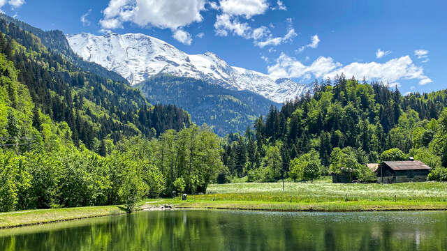
Mountain view
Forest location
Mountain location
Skating rink parking lot.
Overhead parking lot with a total capacity of 90 spaces. 60 spaces in the long-stay zone (parking limited to 7 days) 30 spaces in blue zone (parking limited to 1h30).
Saint-Gervais-les-Bains
Fishing lake
Saint-Gervais-les-Bains
Close
Popular searches
{% label %}
Filter search
Page types
All
Articles
Agenda
Lists
Aucun résultat
/
English
Français
Italiano
Close
×