Itinéraire trail Diagonale du Mont-Joly

  • Sport
  • Pedestrian sports
  • Trail route
Elevation : 1452m
74170 Saint-Gervais-les-Bains
  • Guidebook with maps/step-by-step
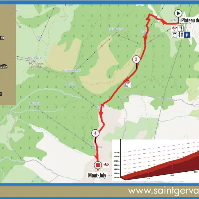
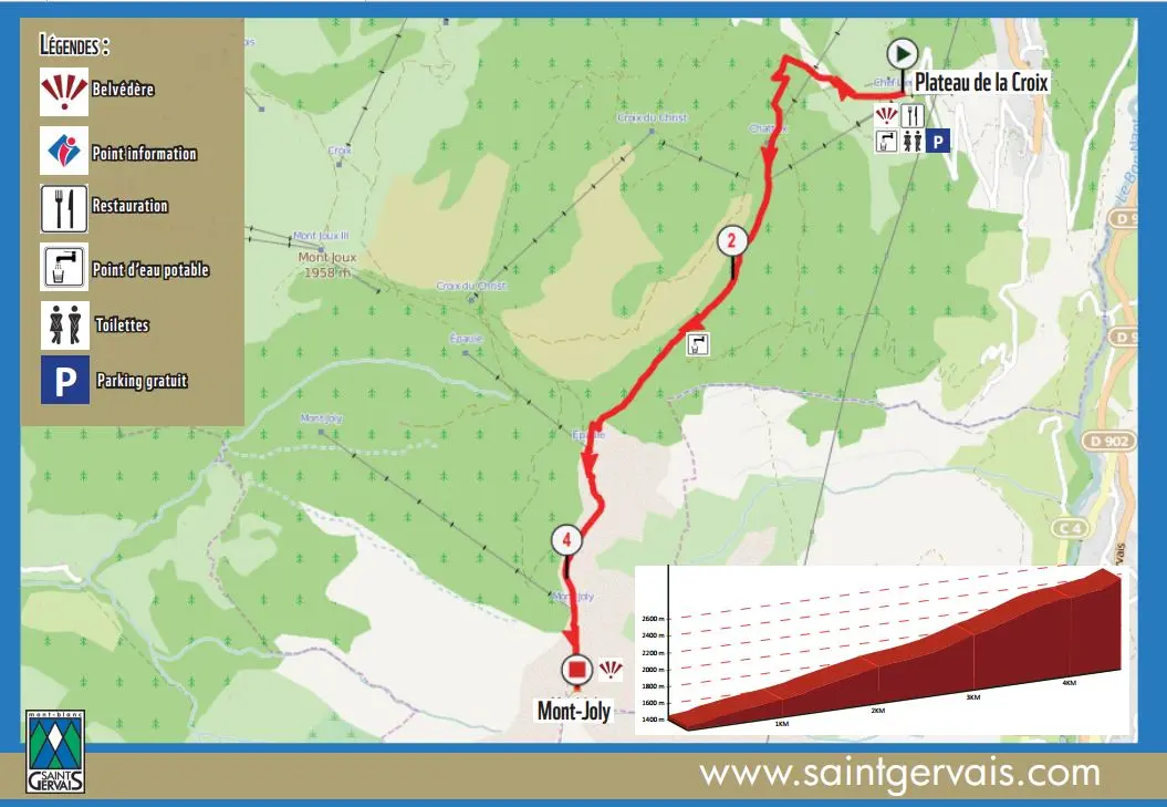
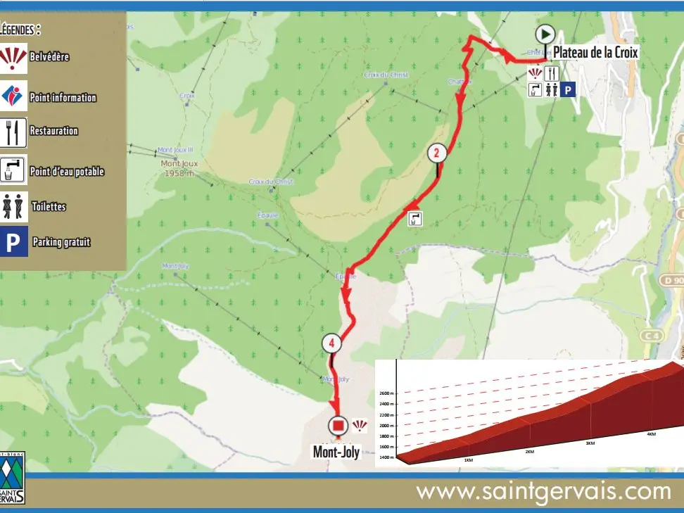
    Route map :

    From the Plateau de la Croix car park in Saint-Nicolas, climb the last 200 metres of tarmac
    metres of tarmac, then follow the most direct paths to Mont-Joly.
    Be careful to follow the paths on the way down.
Plain text period
From 15/05 to 15/11.

Subject to favorable weather.

Documentation

Updated on 12 January 2024 at 15:43
by Office de Tourisme de Saint-Gervais Mont-Blanc
(Offer identifier : 5517233)
Report mistake
Filter search
Page types
  • All
  • Articles
  • Agenda
  • Lists